CONCEPTS in Action
Navigation at Sea
For centuries, crossing the oceans was extremely perilous. There are few landmarks at sea to guide the sailor, and methods of measuring direction, speed, and distance were crude and often inaccurate.
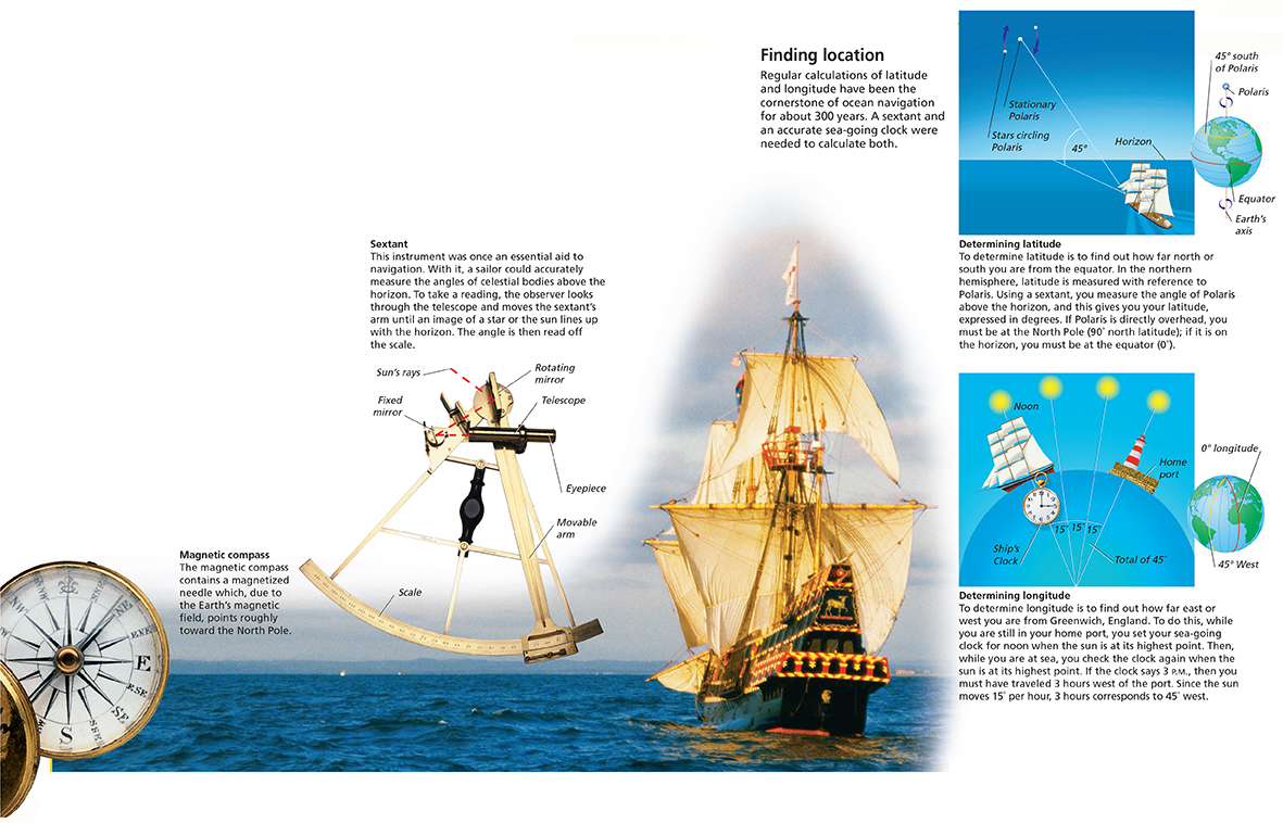
The invention of the magnetic compass brought major advancement in navigation in the early 1100s. Although the compass allowed a sailor to maintain an accurate course, it did nothing to tell him where he actually was. For this, a frame of reference was needed, and the one adopted was the system of latitude and longitude. This system measures location in degrees north or south of the equator, and degrees east or west of Greenwich, England. Using a device called a sextant, latitude in the northern hemisphere was relatively easy to determine. Finding longitude was more difficult. The solution was to combine celestial observation and the use of a highly accurate sea-going clock that kept track of the time at a fixed location on Earth.