Map Projections
Maps are drawings that show regions on flat surfaces. Maps are easier to use and carry than globes, but they cannot show the correct size and shape of every feature on Earth's curved surface. They must shrink some places and stretch others. To make up for this distortion, mapmakers use different map projections. No one projection can accurately show the correct area, shape, distance, and direction for all of Earth's surface. Mapmakers use the projection that has the least distortion for the information they are presenting.
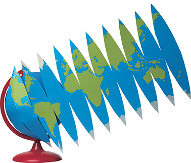
▴ Global gores
Flattening a globe creates a string of shapes called gores.
Image spans to next page
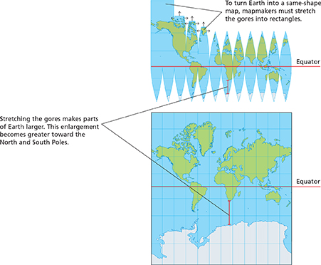
Same-Shape Maps
Map projections that accurately show the shapes of landmasses are called same-shape maps. However, these projections often greatly distort, or make less accurate, the size of landmasses as well as the distance between them. In the projection below, the northern and southern areas of the globe appear more stretched than the areas near the equator.
▴ Mercator projection
One of the most common same-shape maps is the Mercator projection, named for the mapmaker who invented it. The Mercator projection accurately shows shape and direction, but it distorts distance and size. Because the projection shows true directions, ships' navigators use it to chart a straight-line course between two ports.